Directions to Tatran Handball Arena station (Prešov) with public transit
The following transit lines have routes that pass near Tatran Handball Arena
How to get to Tatran Handball Arena station by bus?
Click on the bus route to see step by step directions with maps, line arrival times and updated time schedules.
Bus stops near Tatran Handball Arena in Prešov
- Mestská Hala, 2 min walk,
- Vysokoškolský Areál, 10 min walk,
- Zimný Štadión, 10 min walk,
- Štúrova, 10 min walk,
- Pavlovičovo Námestie, 13 min walk,
Bus lines to Tatran Handball Arena station in Prešov
- 11, Na Rúrkach,
- 43, Veľká Pošta,
- N1, Sídlisko III - Solivarská, Ďalej L. 46 Ruská Nová Ves,
- 5, Dúbrava,
- 34, Sídlisko III - Sibírska,
- 38, Sibírska,
- 15, Za Kalváriou,
- 2, Bajkalská - Obrancov Mieru,
- 7, Budovatelská - Dopravný Podnik,
- 30, Budovateľská,
- 42, Hviezdna,
- 12, Jánošíkova,
What are the closest stations to Tatran Handball Arena?
The closest stations to Tatran Handball Arena are:
- Mestská Hala is 87 meters away, 2 min walk.
- Vysokoškolský Areál is 751 meters away, 10 min walk.
- Zimný Štadión is 758 meters away, 10 min walk.
- Štúrova is 770 meters away, 10 min walk.
- Pavlovičovo Námestie is 961 meters away, 13 min walk.
Which bus lines stop near Tatran Handball Arena?
These bus lines stop near Tatran Handball Arena: 2, 21, 45.
What’s the nearest bus station to Tatran Handball Arena in Prešov?
The nearest bus station to Tatran Handball Arena in Prešov is Mestská Hala. It’s a 2 min walk away.
What time is the first bus to Tatran Handball Arena in Prešov?
The N1 is the first bus that goes to Tatran Handball Arena in Prešov. It stops nearby at 3:06 AM.
What time is the last bus to Tatran Handball Arena in Prešov?
The N1 is the last bus that goes to Tatran Handball Arena in Prešov. It stops nearby at 3:07 AM.
See Tatran Handball Arena, Prešov, on the map
Public Transit to Tatran Handball Arena in Prešov
Wondering how to get to Tatran Handball Arena in Prešov, Slovakia? Moovit helps you find the best way to get to Tatran Handball Arena with step-by-step directions from the nearest public transit station.
Moovit provides free maps and live directions to help you navigate through your city. View schedules, routes, timetables, and find out how long does it take to get to Tatran Handball Arena in real time.
Looking for the nearest stop or station to Tatran Handball Arena? Check out this list of stops closest to your destination: Mestská Hala; Vysokoškolský Areál; Zimný Štadión; Štúrova; Pavlovičovo Námestie.
Bus: 2, 21, 45, 11, 43, 15, N1, 5, 34, 38, 7, 30, 42, 12.
Want to see if there’s another route that gets you there at an earlier time? Moovit helps you find alternative routes or times. Get directions from and directions to Tatran Handball Arena easily from the Moovit App or Website.
We make riding to Tatran Handball Arena easy, which is why over 1.5 million users, including users in Prešov, trust Moovit as the best app for public transit. You don’t need to download an individual bus app or train app, Moovit is your all-in-one transit app that helps you find the best bus time or train time available.
For information on prices of bus, costs and ride fares to Tatran Handball Arena, please check the Moovit app.
Use the app to navigate to popular places including to the airport, hospital, stadium, grocery store, mall, coffee shop, school, college, and university.
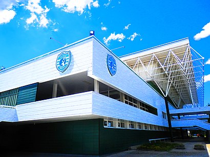
Tatran Handball Arena Address: Športová 2 street in Prešov
Places Near Tatran Handball Arena (Prešov)
Get around Prešov by public transit!
Traveling around Prešov has never been so easy. See step by step directions as you travel to any attraction, street or major public transit station. View bus and train schedules, arrival times, service alerts and detailed routes on a map, so you know exactly how to get to anywhere in Prešov.
When traveling to any destination around Prešov use Moovit's Live Directions with Get Off Notifications to know exactly where and how far to walk, how long to wait for your line, and how many stops are left. Moovit will alert you when it's time to get off — no need to constantly re-check whether yours is the next stop.
Wondering how to use public transit in Prešov or how to pay for public transit in Prešov? Moovit public transit app can help you navigate your way with public transit easily, and at minimum cost. It includes public transit fees, ticket prices, and costs. Looking for a map of Prešov public transit lines? Moovit public transit app shows all public transit maps in Prešov with all bus routes and stops on an interactive map.
Presov has 1 transit type(s), including: bus, operated by several transit agencies, including DPMP, a.s. Prešov